
Wildfire Smoke in the North Cascades: How to Check AQI and Choose a Plan B
Last updated: July 2026
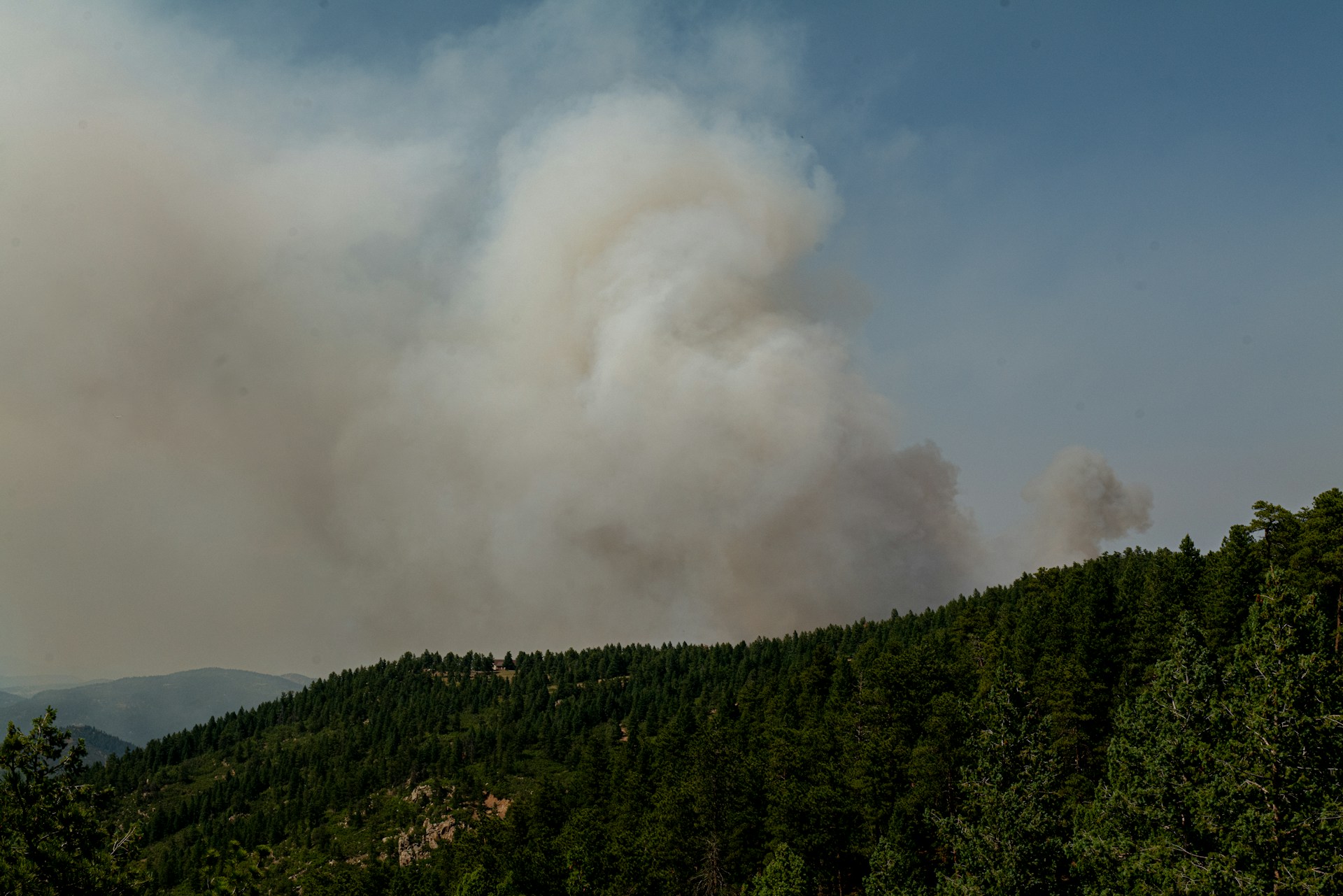
Wildfire smoke can change a North Cascades Highway trip even when SR-20 is open. Use this guide to check AQI, avoid the biggest corridor mistakes, and choose a safer Plan B before you drive too far past Marblemount or Newhalem.
For current road, smoke, and weekend planning updates, get the Cascades Field Guide newsletter.
Quick Decision Guide
AQI: Start with the Fire and Smoke Map. It shows PM2.5 smoke pollution, fire locations, and smoke plumes. Do not rely on a Seattle AQI reading for a Diablo or Washington Pass trip.
- Green or yellow AQI: Keep your plan, but check the exact corridor segment you are using. Concrete, Newhalem, Diablo, Washington Pass, Mazama, and Winthrop can show different smoke conditions on the same day.
- Orange AQI: Shorten the day if anyone in your group is sensitive to smoke. Pick short stops before or around Newhalem instead of a long hike east of Diablo or up Cascade River Road.
- Red or worse AQI: Do not force a hike. Everyone should reduce exposure at this level, and a long trail day gives you fewer ways to leave if smoke gets worse.
Smoke plus fire closure: Closure status wins. If a road, trail, campground, or area is closed, good AQI nearby does not make it usable.
Low visibility: Treat this as a planning problem, not just a health problem. Diablo Lake Overlook, Washington Pass Overlook, and larch hikes can lose most of their value when smoke hides the views.
What I would do: Make the go/no-go call before Marblemount if your plan includes Cascade River Road, Newhalem, Diablo, or Washington Pass. After Marblemount, services and cell coverage get thinner fast.
For a same-week read, check This Weekend’s North Cascades Plan before you commit to the long drive.
Check Before Marblemount
Use Marblemount as your last practical decision point on a west-to-east SR-20 trip. It sits before the road feels remote, before the Cascade River Road turnoff near SR-20 mile marker 106, and before the Newhalem-Diablo corridor.
AQI: Start with the Fire and Smoke Map. It shows PM2.5 smoke pollution, fire locations, and smoke plumes. Do not rely on a Seattle AQI reading for a Diablo or Washington Pass trip.
Smoke forecast: Use the Washington Smoke Blog when smoke is active. It is more useful than a generic weather app because it focuses on smoke movement and regional air quality.
Roads and closures: Check SR-20 pass status and park road conditions before leaving cell service. SR-20 and side roads can have different closure problems.
Common mistake: Visitors see “road open” and assume the trip is good. Open road only means access. It does not mean clean air, clear views, safe hiking, or usable trailheads.
For a broader official-source checklist, use Current North Cascades Conditions.
How Smoke Changes SR-20
West side: Concrete, Rockport, and Marblemount are the safer places to pause, check sources, buy food, and decide whether to continue. They are better decision points than Newhalem if smoke is already obvious on the drive east.
Newhalem and Diablo: These stops work better than high trailheads when smoke is moderate because you can keep the day short. Newhalem, Gorge Creek Falls, and Diablo Lake Overlook are easier to abandon than a long hike east of Diablo.
Cascade River Road: Decide before turning off SR-20 near Marblemount. This side road adds commitment, has weaker fallback options, and should not be used as a casual “maybe it will clear” Plan B.
Rainy Pass and Washington Pass: Do not assume the pass is clearer than the west side. Check an east-side reading near Mazama or Winthrop before driving all the way to Blue Lake, Maple Pass, Rainy Pass, or Washington Pass.
This is where people misjudge the corridor: Winthrop can still have restaurants, lodging, and fuel when nearby pass hikes are smoky. A service town being usable does not mean the high trailheads are a good plan.
For the seasonal pattern behind smoke, larches, snow, and access, see Best Time to Visit North Cascades.
Plan A and Plan B
Plan A: clear or mostly clear corridor. Keep the normal SR-20 plan. For a short day, use Newhalem, Gorge Creek Falls, Diablo Lake Overlook, and one easy walk. For a full day, continue toward Rainy Pass and Washington Pass only after checking east-side smoke and SR-20 status.
Plan B: smoke is worse east of Diablo. Stay west of the high passes. Use Newhalem, short roadside stops, Rockport, Concrete, or a food-and-services reset instead of forcing Maple Pass, Blue Lake, or Washington Pass.
Plan B: smoke is worse on the west side. If SR-20 is open and the east side is clearly better, Mazama or Winthrop may work as the cleaner base. The tradeoff is distance. Do not make that pivot unless the east-side AQI and road status support it.
Plan B: smoke is moderate but rising. Choose stops where you can leave fast. Gorge Creek Falls, Diablo Lake Overlook, Newhalem-area walks, and food stops are safer choices than a long trail with no quick exit.
Plan B: the whole corridor is smoky. Reduce exposure and do less. Eat locally, adjust lodging, skip the hike, and save the long viewpoint or trail day for cleaner air.
For more non-smoke backup ideas, use North Cascades Backup Plans.
Good Smoke-Day Pivots
Food and services reset: Concrete, Rockport, and Marblemount are useful when you need to pause before committing east. Use them for fuel, food, restrooms, and a source check before the road gets more remote.
Short scenic stops: Newhalem, Gorge Creek Falls, and Diablo Lake Overlook are better than long hikes when smoke is uncertain. They keep the day flexible and reduce time outside.
Baker Lake Road: This can be a good west-side pivot only when smoke is clearly better there. It is not automatically safer than SR-20. Check conditions first because it is a real side trip, not a quick pullout.
Where to stay: If smoke favors one side of the mountains, shift your base instead of trying to commute through bad air. West-side bases work better for Newhalem, Diablo, and Cascade River Road. East-side bases work better for Washington Pass, Rainy Pass, Mazama, and Winthrop.
Use Food, Fuel, and Services if you need to regroup, or Where to Stay Near North Cascades if smoke changes your overnight plan.
Sources to Check
Use these official or operational sources before making a smoke-season driving or hiking decision:
- AirNow Fire and Smoke Map for current PM2.5 smoke, fire locations, and smoke plumes.
- AirNow AQI Basics for AQI categories and health meaning.
- Washington Wildfire Smoke for state smoke and AQI guidance.
- Washington Smoke Blog for smoke forecasts and regional smoke notes.
- WSDOT SR-20 Pass Report for current North Cascades Highway status.
- North Cascades Road Conditions for park road and side-road status.
- North Cascades Fire Closures for fire-related trail, area, and camp closures.
Related Guides
Conditions can change quickly. This guide is for trip planning, not medical advice or a live closure report. Check official AQI, smoke, road, and fire-closure sources before driving, and use a lower risk threshold for children, older adults, pregnant travelers, and anyone with heart or lung concerns.
