
Cascade River Road Guide: Access, Trailheads, Campgrounds, and Stops
Last updated: July 2026
Cascade River Road runs 23.1 miles from SR 20 in Marblemount to the Cascade Pass Trailhead. It is the access route for Cascade Pass and Sahale Arm, but it also reaches lower-road hikes, two public campgrounds, Hidden Lake’s separate forest-road approach, climber access, and a few worthwhile roadside stops.
Plan this road by destination rather than treating it as one continuous scenic drive. A closure near the top may still leave lower-road stops, campgrounds, or trailheads reachable. The reverse is also true: reaching the lower road does not mean the upper trailhead is open, your vehicle is suitable, or parking will be available.
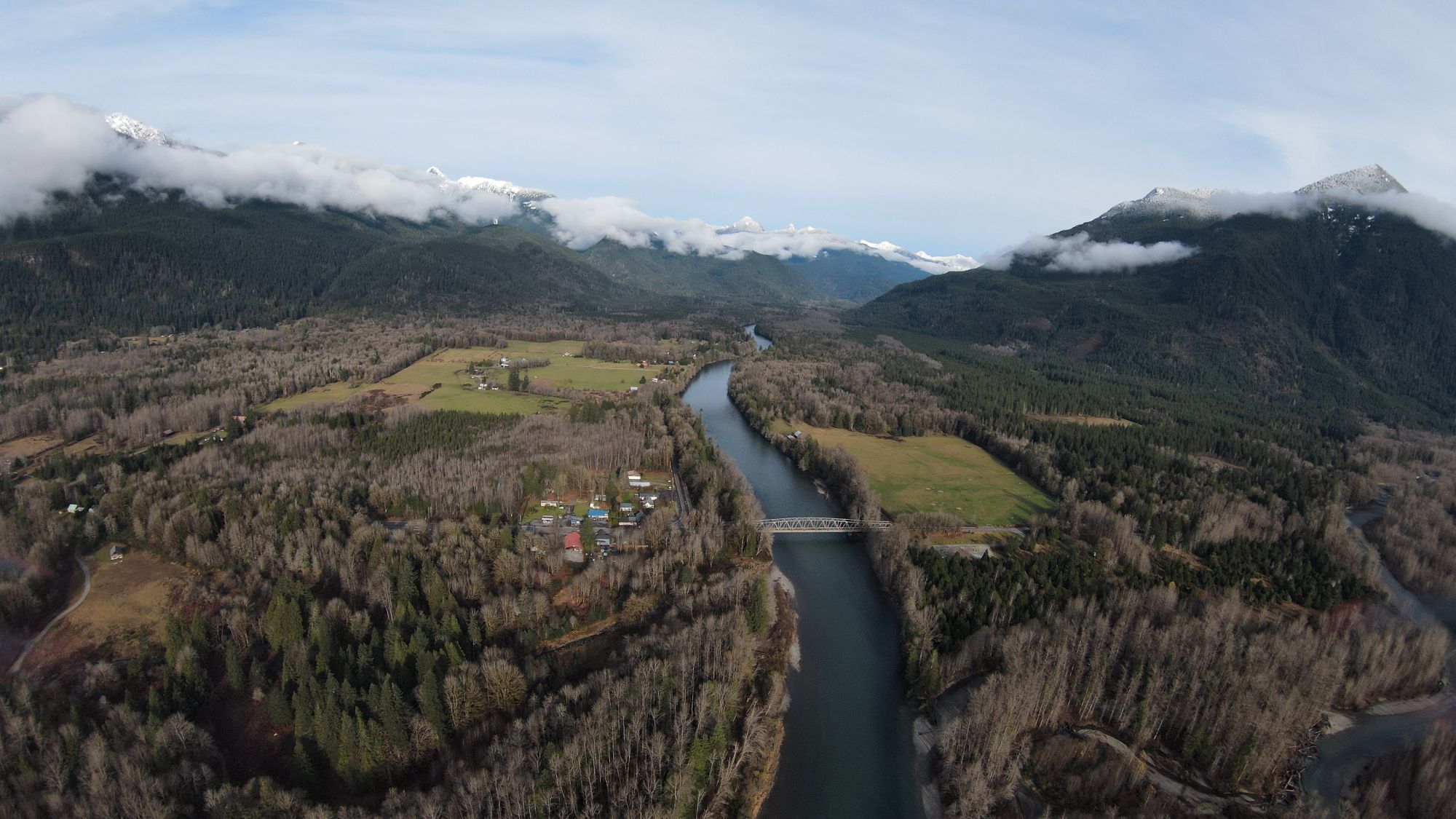
Bridge to Cascade River Road at Marblemount, Washington. Photo: © 2026 CascadesFieldGuide.com. All rights reserved.
Quick Decision Guide: Choose your Cascade River Road plan
Start with your furthest objective. The road is only as useful as the destination you can actually reach. Choose the access system first, then check the road, parking, trail, and facility layers that can break that plan.
Short scenic drive and roadside stops
Required access: Lower road, with a planned turnaround
Mystery Falls and the National Forest boundary viewpoint can make a useful short outing. The road is still strongest when paired with a campground, hike, or deliberate endpoint.
Lookout Mountain or Monogram Lake
Required access: Shared lower-road trailhead about 6.5–7 miles from Marblemount
Both are long, demanding hikes using the same small pullout. Switching between them does not solve a parking problem.
Hidden Lake
Required access: Cascade River Road plus Forest Road 1540
Treat this as its own plan. The spur is rough, high clearance is recommended, parking pressure is high, and there is no trailhead restroom.
Marble Creek or Mineral Park camping
Required access: Lower or middle main road
Good bases for early starts, but road access, campground operation, and actual campsite availability are separate checks.
Cascade Pass or Sahale Arm
Required access: Full road through the final upper segment
This is the highest-commitment plan: seasonal road access, high-clearance guidance, very high parking pressure, trail conditions, and possible overnight permits all matter.
Specialist climbing or unmaintained routes
Required access: Eldorado, Boston Basin, Forest Roads 1590, 1550, or 1570
These require separate technical research. They are not casual backups when a mainstream trailhead is unavailable.
Related Guides
Cascade River Road at a glance
Full road length: 23.1 miles from SR 20 in Marblemount to Cascade Pass Trailhead.
Surface: Paved to approximately mile 10, then rough gravel. The final three miles above Eldorado are narrow and steep.
Typical full-road season: The upper trailhead usually becomes reachable in late June or early July and remains accessible into fall, conditions permitting. Lower portions can have a longer access window, usually year-round.
Vehicle fit: High clearance is recommended for the full road. Inside the park boundary, vehicles over 22 feet long or 8 feet wide are prohibited.
Driving commitment: Allow roughly 60–90 minutes each way from Marblemount to the road end when the full route is open, before parking search or stops.
Management: The road crosses county, Forest Service, and National Park Service jurisdiction. The correct status source depends on the location and issue.
Lower road: Marblemount to Marble Creek
Marblemount is the practical staging point. Handle fuel, food, water, restroom needs, downloaded maps, and group coordination before turning south from SR 20. Services are limited and seasonal details change, so use the dedicated Marblemount services guide rather than assuming every business will be open or offer a restroom.
The road remains paved through most of this segment. Lower-road access can still be useful when the road is closed farther uphill, but always check the exact closure endpoint. A report that the road is open to a lower campground or control point does not establish access to Hidden Lake, Eldorado, or Cascade Pass.
Mystery Falls: an informal roadside waterfall stop
Mystery Falls is an unofficial name for a waterfall visible directly beside Cascade River Road. A specialist waterfall survey describes perennial flow, with stronger spring flow and less visual impact late in summer.
Field observations identify informal roadside pullouts within roughly 200 feet on either side, with combined room for about two or three ordinary passenger vehicles. These are not developed parking spaces. Stop only when the vehicle can be fully off the traveled road, sight distance and traffic make the stop reasonable, and no sign or current restriction prohibits it. A private residence is adjacent; do not enter the property or climb upstream.
National Forest boundary sign and nearby viewpoint
Around the 6.5–7 mile range, the Mt. Baker–Snoqualmie National Forest boundary sign provides a useful route landmark. A field observation places the sign at roughly 6.6 miles from Marblemount, and visitors commonly make brief photo stops beside it.
A separate, larger open area shortly after the sign provides a broader viewpoint and field-observed room for at least four ordinary passenger vehicles. Treat the sign pullout and the viewpoint as two nearby but distinct roadside spaces. Neither is a striped or agency-developed overlook, and availability is never guaranteed.
Lookout Mountain and Monogram Lake
The shared Lookout Mountain–Monogram Lake trailhead is a small signed gravel pullout about 6.5–7 miles from Marblemount. No on-site restroom is documented. The lower road may be accessible outside the ordinary alpine hiking season, but both hikes are usually summer-to-early-fall objectives and should be checked for current trail conditions.
Lookout Mountain is roughly 9.4 miles round trip. Monogram Lake is about 10 miles round trip with 4,040 feet of gain and is rated strenuous. Both require a substantial hiking day. The routes share their initial trail and parking area, but dog and fee rules are not identical. Leashed dogs are allowed on the Forest Service Lookout Mountain route, while dogs are prohibited on the Monogram Lake route within the national park. Verify current pass treatment for the shared pullout before leaving.
Marble Creek Campground
Marble Creek Campground is about 8.6 miles from Marblemount and is the lower of the two developed public campgrounds on the road. It has 22 sites, including 20 single and two double sites, and is reservable through Recreation.gov. Typical operation is May through September, subject to road and facility conditions.
The campground has vault toilets and garbage bins but no potable water. RV and trailer fit is site-specific; do not apply the length shown for one reservable site to the entire campground. Do not use the campground as the corridor's guaranteed restroom plan; facility operation is seasonal and the official listing does not establish unrestricted day-use restroom access.
Middle road: Marble Creek to Mineral Park and Forest Road 1590
The road changes from pavement to rough gravel at approximately mile 10. This is the point where road condition, clearance, tire condition, and comfort with a slower mountain-road drive matter more. The road may be usable to some middle-road destinations while remaining closed farther uphill.
Hidden Lake and Forest Road 1540
Forest Road 1540 branches from Cascade River Road about 9.7 miles from Marblemount and continues about 4.5–4.7 miles to the Hidden Lake Trailhead. It is a separate access system, not part of the main-road status by default. High clearance is recommended, maintenance is intermittent, turnaround opportunities are limited, and RVs or trailers should not enter expecting a dependable place to turn around.
Hidden Lake Trail is about 9 miles round trip with 2,900 feet of gain, making it a substantial hiking day. Ordinary access is usually late July into early fall, depending on snow and road conditions. Parking pressure is high, the parking area is gravel, no reliable capacity has been established, and no on-site restroom is provided at the trailhead. Check current pass treatment and both the main road and Forest Road 1540 before committing.
Mineral Park Campground
Mineral Park Campground lies about 15–16 miles up Cascade River Road near the confluence of the North and South Forks. It has 20 reservable sites: 18 single and two double sites. Typical operation is May through September, subject to road access and facility conditions.
Amenities include vault toilets, picnic tables, and campfire rings. There is no potable water and no hookups. RV and trailer fit is site-specific and generally favors smaller equipment; one site listing cannot be used as a campground-wide maximum. A designated day-use picnic site is listed, but restroom use by non-campers depends on the facility being open and the applicable day-use payment or pass rules.
Forest Road 1590
Forest Road 1590 branches near mile 17, close to Mineral Park, and is permanently closed to public motor vehicles beyond the gate. Visitors continue on foot along the closed road to the old shared access for the Middle and South Fork Cascade River trails.
A field observation suggests room for roughly two or three ordinary vehicles near the gate, but no marked or officially confirmed capacity is established. Both routes are damaged, unmaintained, and not recommended by the official source. They belong in advanced backcountry planning, not in a last-minute list of alternatives.
Eldorado mile 20: control point and turnaround
Eldorado Creek near mile 20 is an important planning landmark. It is the larger-vehicle turnaround before the narrow upper road and has also been used as a winter or emergency closure-control point. It is not a permanent closure point: the exact endpoint changes with snow, damage, repairs, and agency decisions.
When a status report says the road is open to Eldorado, that generally means the final three miles to Cascade Pass Trailhead are still unavailable to ordinary vehicles. Eldorado also serves climber access, so it should not be treated as dependable overflow parking for Cascade Pass. Use designated parking only and turn around if the area is full.
Upper road: Eldorado to Cascade Pass Trailhead
The final three miles are the narrowest and steepest portion of Cascade River Road. High clearance is recommended, and vehicles over 22 feet long or 8 feet wide are prohibited within the park boundary. This segment usually opens later than the lower road and is often the portion that determines whether a Cascade Pass plan is possible.
A waterfall is visible along the upper approach, but no safe or designated stopping place is established. Treat it as scenery from the drive. Do not stop on the roadway; use designated parking areas only.
Cascade Pass Trailhead is at the road end, 23.1 miles from SR 20. Cascade Pass itself is 7.4 miles round trip with 1,700 feet of gain. Sahale Arm to the glacier area extends the trip to roughly 11.8 miles and 3,940 feet of gain. Dogs are prohibited. There is no trailhead or parking fee for these NPS routes, but overnight backcountry trips require permits.
A trailhead toilet or restroom is documented and is normally expected to be available when the road is open to the trailhead, but it is not guaranteed. An open gate does not prove that the toilet is serviceable, the trail is snow-free, or parking is available.
Parking can decide the trip
Do not treat every trailhead as interchangeable. Several destinations share parking, while others use independent roads with their own failure points.
- Cascade Pass: The gravel lot holds roughly 30–40 vehicles. Peak pressure is very high. Roadside parking has been observed, but the National Park Service does not designate the road as overflow parking. Arrive early, but do not rely on a fixed fill time or later-morning turnover; many vehicles may belong to overnight hikers.
- Lookout Mountain and Monogram Lake: Both hikes use one small signed gravel pullout. Capacity has not been reliably established. If it is full, choosing the other hike does not create another parking option because the access is shared.
- Hidden Lake: Parking pressure is high and no dependable capacity is established. Park only where current rules allow, fully off the road, without blocking emergency access or damaging vegetation. Do not enter the spur assuming there will be an easy turnaround.
- Eldorado: This is a control, turnaround, parking, and climber-access area, not a guaranteed Cascade Pass overflow lot. Use designated parking and turn around if the area is full.
- Forest Road 1590 gate: Specialist access only. Field observation suggests room for roughly two or three ordinary vehicles near the gate; no marked capacity or additional overflow should be assumed.
Public campgrounds on Cascade River Road
Use this comparison to choose the road depth and facility level that fit the trip. The detailed road-segment sections above explain each campground in context.
Marble Creek
Location and fit: About 8.6 miles from Marblemount; 22 reservable sites; useful lower-road base
Facilities: Vault toilets, garbage bins, no potable water
Planning caution: Typical May–September operation; verify road, facility alerts, reservation inventory, and site-specific vehicle fit.
Mineral Park
Location and fit: About 15–16 miles from Marblemount; 20 reservable sites; deeper and more remote
Facilities: Vault toilets, tables, fire rings, no potable water or hookups
Planning caution: Typical May–September operation; smaller equipment generally fits better; verify road, facility alerts, and inventory separately.
An open road does not prove that a campground is operating or that a site is available. Check the facility page and reservation inventory separately.
Facilities, rules, and before-you-go logistics
- Set up in Marblemount: Handle fuel, food, water, restroom needs, maps, and group coordination before entering the road. Use the dedicated services page for current businesses and hours.
- Bring water: Neither Marble Creek nor Mineral Park provides potable water.
- Do not depend on trailhead restrooms: Lookout–Monogram has no documented on-site restroom, and Hidden Lake has no on-site restroom. The Cascade Pass toilet is seasonal and conditional on full-road access and facility service.
- Separate fee systems: Cascade Pass has no day-use parking fee. Forest Service trailhead pass treatment can differ by location and should be checked. Campgrounds charge facility fees.
- Check dog rules by destination: Dogs are prohibited on Cascade Pass, Sahale Arm, and Monogram Lake. Lookout Mountain allows leashed dogs. On Hidden Lake Trail, leashed pets are allowed on the Forest Service trail and at the lookout, but not after the route enters North Cascades National Park toward Hidden Lake.
- Separate day use from overnight rules: Day hiking and overnight backcountry use are not the same permit question. Check permits early when camping is part of the plan.
- Respect vehicle limits: High clearance is recommended for the full road. Large vehicles should not proceed into the upper NPS segment, and rough spurs have additional practical limits.
Specialist access beyond the ordinary guide
Cascade River Road also serves undeveloped climber access at Eldorado and Boston Basin, gated pedestrian access on Forest Road 1590, specialist river or canyon access from Forest Road 1550, and rough remote approaches from Forest Road 1570 toward Snowking and Cyclone objectives.
These are not ordinary substitutes for Cascade Pass, Hidden Lake, or a campground. Conditions, route finding, parking, permits, and technical hazards require separate research; this guide does not provide detailed directions for those routes.
How to verify the plan near your trip date
Use three separate checks: one while choosing the trip, one during the week before it, and one before leaving Marblemount. No single source proves the entire plan.
- When choosing dates: Use the evergreen guide to identify the required road segment, normal seasonal window, vehicle fit, campground reservation needs, and permit requirements. A typical seasonal window is not a current road report.
- During the week before the trip: Check the NPS Cascade River Road page and NPS road conditions for the exact vehicle endpoint. Check NPS trail conditions for Cascade Pass and upper routes, USFS conditions and alerts for Forest Service spurs and campgrounds, Recreation.gov for operating alerts and inventory, and weather and smoke sources for the trip window.
- Before leaving Marblemount: Recheck the road report, weather, and smoke; download maps; confirm fuel, food, and water; and make sure the group agrees on a backup. Informal roadside stop descriptions never guarantee that a pullout will be safe or available when you arrive.
Frequently asked questions
Is Cascade River Road worth driving without a major hike?
Sometimes. The lower road can support a short plan built around Mystery Falls, the boundary sign and nearby viewpoint, river and forest scenery, or a campground. It is not a continuous developed scenic drive, so choose a turnaround point before committing to the upper road.
Does a closure before Cascade Pass close everything?
No. Lower-road hikes, campgrounds, or the Hidden Lake turnoff may remain usable depending on the exact closure endpoint. Check the dependency for your destination rather than relying on a simple open-or-closed label.
Can a regular passenger car drive the road?
The National Park Service recommends high clearance for the full road and says it is not suitable for sedans or low-clearance vehicles. Lower-road conditions and separate spurs still need their own checks.
Can an RV or long trailer use Cascade River Road?
The upper road is a poor fit, and within the park boundary vehicles over 22 feet long or 8 feet wide are prohibited. Campground site limits are separate and site-specific.
What if Cascade Pass parking is full?
Do not rely on roadside spillover as authorized overflow. Turn around or use a backup chosen in advance. A real backup must have an independent road and parking system; another destination using the same lot is not a backup.
Is Hidden Lake a good fallback for Cascade Pass?
Only when it was researched as its own plan. Hidden Lake uses Forest Road 1540, has rough-road and turnaround concerns, high parking pressure, no on-site restroom, and its own snow and pass questions.
Are the campgrounds open whenever the road is open?
No. Road access, campground operating dates, facility alerts, reservation inventory, and site availability are separate checks.
Where are the useful short stops?
Mystery Falls and the National Forest boundary sign with its nearby informal viewpoint are the strongest lower-road additions. The upper-road waterfall is scenery only because no safe or designated stopping place is established.
Is there a restroom at Cascade Pass Trailhead?
A trailhead toilet or restroom is documented and is normally expected when the road is open to the end, but it is not guaranteed. Use a confirmed facility before entering the corridor rather than making the road-end toilet your only plan.
Sources
- NPS: Cascade River Road
- NPS: Road Conditions
- NPS: Cascade Pass / Sahale Arm Trail
- NPS: Trail Conditions
- NPS: Fees and Passes
- NPS: Pets
- USFS: Lookout Mountain–Monogram Lake Trail 743
- NPS: Monogram Lake Trail
- USFS: Hidden Lake Trail 745
- NPS: Hidden Lake Trail
- USFS: Marble Creek Campground
- Recreation.gov: Marble Creek Campground
- USFS: Mineral Park Campground
- Recreation.gov: Mineral Park Campground
- USFS: Middle Fork Cascade River Trail 769.1
- USFS: South Fork Cascade River Trail 769.2
- Waterfalls Northwest: Mystery Falls
- WTA: Cascade Pass parking context
- CFG field observations
Publication candidate audited against CFG v1.3.4: July 29, 2026.
