
Family-Friendly North Cascades: Short Hikes and Easy Stops
Last updated: May 2026
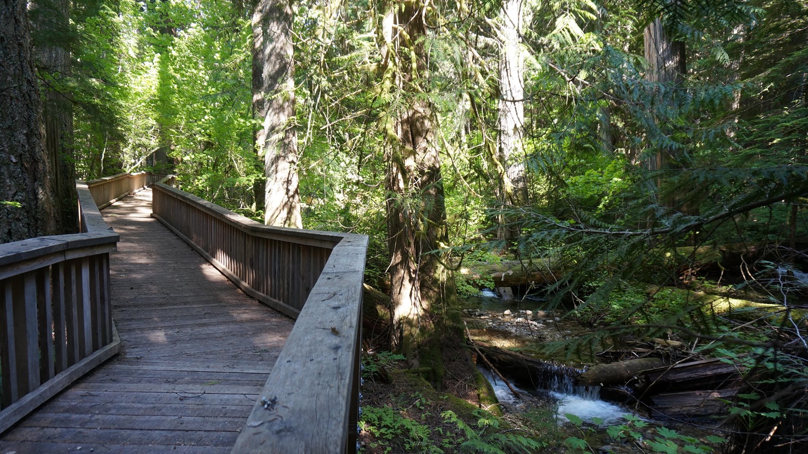
Boardwalk loop through old-growth forest at Happy Creek Forest Walk along Highway 20. Attribution: NPS Public Domain
This guide is for families trying to make a North Cascades day actually work: short walks, easy viewpoints, realistic drive planning, bathroom and snack logic, and backup stops when SR 20 access, parking, weather, or kid morale changes the plan.
The main rule is simple: do not build a family day around seeing everything. Pick one anchor activity, add two short scenic stops, and keep one easy reset stop in your back pocket. A successful family trip is usually one easy walk, one big view, one food break, and no forced march at the end of the day.
If You Only Read One Section
With younger kids, start west-side: Newhalem, Sterling Munro Boardwalk, Gorge Creek Falls, Diablo Lake Overlook, Happy Creek Forest Walk, and River Loop are the safest core family stops.
If SR 20 is fully open and the day is going well: Rainy Lake and Washington Pass Overlook can become the higher-elevation payoff stops.
If parking, weather, or patience collapses: stop adding hikes. Switch to short scenic stops, a food reset, or an early exit. That is better than turning a good family day into a bad long one.
Click to Get Trail and Road Updates
Fast Family Picks
Use these as decision blocks instead of trying to compare every stop at once. Pick the stop that matches your family’s actual situation that day: stroller, tired kids, parking stress, SR 20 access, or the need for a fast scenic win.
Sterling Munro Boardwalk
Best for: toddlers, strollers, grandparents, first stop of the day, or a short reset near Newhalem.
Why it works: NPS describes Sterling Munro as a 330-foot boardwalk behind the North Cascades Visitor Center, so it gives families a real stop without committing to a hike.
Skip or downgrade if: the visitor center area is closed, crowded, or you are trying to move deeper into the corridor quickly.
Best backup: River Loop Trail if you want a longer mellow walk, or Gorge Creek Falls if you want a faster scenic stop.
Gorge Creek Falls
Best for: a fast scenic payoff with minimal walking.
Why it works: this is one of the best family stops when you want something memorable without turning the stop into a full hike. NPS notes the falls drop 242 feet.
Skip or downgrade if: your family needs a longer bathroom, snack, or run-around reset instead of a roadside viewpoint.
Best backup: Diablo Lake Overlook if parking is reasonable.
Diablo Lake Overlook
Best for: the classic North Cascades view without a hike.
Why it works: this is the postcard stop for many first-time families, but the real issue is parking, not walking distance.
Skip or downgrade if: the lot is full, visibility is poor, or kids are already losing patience with car-to-viewpoint stops.
Best backup: Happy Creek Forest Walk, then retry the overlook later if the day still has room.
Happy Creek Forest Walk
Best for: strollers, tired kids, short forest time, and a low-pressure fallback near the Diablo corridor.
Why it works: NPS describes Happy Creek as a 0.3-mile loop and notes it is accessible, with most of the loop on boardwalk.
Skip or downgrade if: your family needs big mountain views more than a quiet forest reset.
Best backup: Diablo Lake Overlook if parking has opened up.
River Loop Trail
Best for: families who want a mellow real walk near Newhalem.
Why it works: NPS lists River Loop as a 1.8-mile loop. It gives kids more movement than a viewpoint without becoming a major hiking commitment.
Skip or downgrade if: you are already behind schedule, very young kids are fading, or the family only has one short stop left.
Best backup: Sterling Munro Boardwalk for a shorter version.
Thunder Knob
Best for: older kids or families who are comfortable doing a real hike.
Why it works: NPS lists Thunder Knob as 3.6 miles roundtrip with 425 feet of gain. It is one of the better family view hikes, but it is not a casual quick stop.
Skip or downgrade if: it is late, hot, crowded, or you still have a long drive home.
Best backup: Happy Creek Forest Walk or Diablo Lake Overlook.
Rainy Lake
Best for: the easiest alpine-lake payoff when SR 20 is open and conditions are good.
Why it works: WTA lists Rainy Lake as 2.0 miles roundtrip with 70 feet of elevation gain. It is one of the best high-country family options when access lines up.
Skip or downgrade if: SR 20 is closed, snow remains, the Rainy Pass area is crowded, or the drive is already too long for the family.
Best backup: Washington Pass Overlook if you still want a high-country view, or a west-side-only day if access is limited.
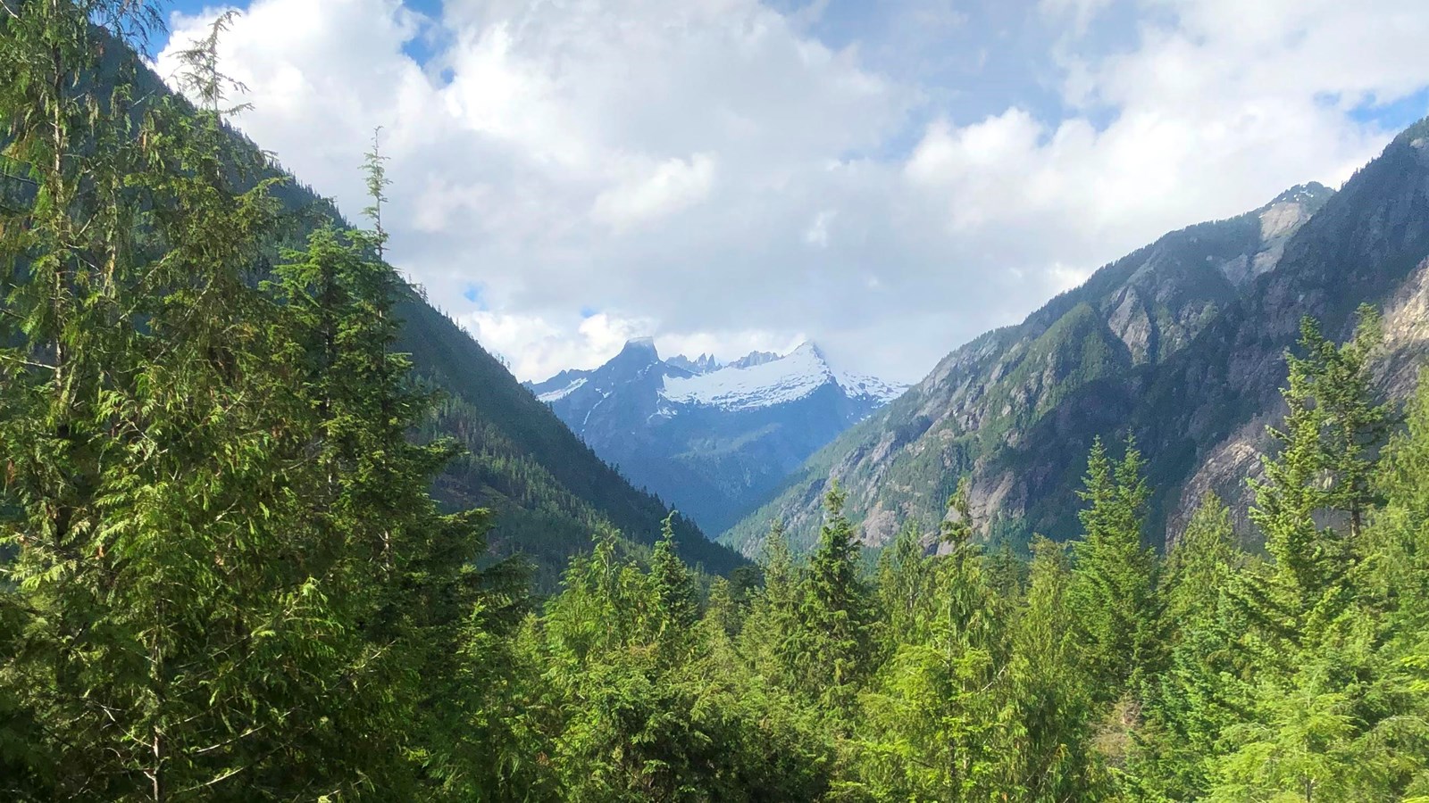
Washington Pass Overlook
Best for: a huge high-country view with short walking when SR 20 is fully open.
Why it works: it gives families a major scenic payoff without requiring a long hike, but it depends heavily on road access and visibility.
Skip or downgrade if: visibility is poor, SR 20 access is uncertain, wind is making the stop unpleasant, or the day is already running long.
Best backup: Rainy Lake if trail conditions and parking are better, or skip the high country and keep the day west-side.
Best Stops by Family Type
Toddlers, Strollers, and Very Short Attention Spans
Best choices: Sterling Munro Boardwalk, Happy Creek Forest Walk, Gorge Creek Falls, Diablo Lake Overlook, and short Newhalem-area stops. Keep the day simple and avoid turning every stop into a production.
Do not overdo it: Thunder Knob is probably too much for most toddler-focused days unless you are carrying a kid and know exactly what you are signing up for. Rainy Lake can work when SR 20 is open, but the drive length matters as much as the trail.
Elementary-Age Kids
Best choices: River Loop Trail, Happy Creek Forest Walk, Gorge Creek Falls, Diablo Lake Overlook, Rainy Lake when open, and Washington Pass Overlook if the drive is worth it. This is the age where short walks plus big views usually beat one long hike.
Best rhythm: alternate movement and reward. Walk, view, snack, drive, short stop, then decide whether the family has another walk left.
Older Kids and Strong Walkers
Best choices: Thunder Knob, Rainy Lake, Blue Lake as a more serious option, and selected Washington Pass stops. Older kids can handle a more ambitious day, but the same rule applies: do not stack too many “just one more stop” decisions.
Be honest about difficulty: Thunder Knob is short compared with major North Cascades hikes, but it is still a real hike. Blue Lake is not a throwaway easy stop. Maple Pass is not a casual family default unless your family is already trail-capable.
Grandparents, Mixed Abilities, or Limited Mobility
Best choices: Sterling Munro Boardwalk, Happy Creek Forest Walk, Gorge Creek Falls, Diablo Lake Overlook, Washington Pass Overlook when open, and other short scenic stops. These let the group enjoy the corridor without forcing everyone onto the same hiking plan.
The Best Easy Stops With Minimal Walking
- North Cascades Visitor Center and Sterling Munro Boardwalk: This is the easiest first reset stop near Newhalem. NPS describes Sterling Munro as a 330-foot boardwalk behind the visitor center, which makes it useful for toddlers, strollers, grandparents, and short attention spans. Check the NPS Sterling Munro page.
- Gorge Creek Falls: This is one of the strongest family stops because the payoff is fast. NPS notes Gorge Creek Falls drops 242 feet, and the stop does not require turning the day into a hike. Check the NPS Gorge Creek Falls page.
- Diablo Lake Overlook: This is the classic view stop, but parking is the real family issue. If the lot is full, do not circle until everyone is irritated. Go to Happy Creek Forest Walk or another short stop and retry later if it still makes sense.
- Washington Pass Overlook: When SR 20 is fully open, this is one of the best high-country views with limited walking. It belongs in a family plan only when road access, timing, and visibility are working in your favor.
Attribution: NPS / Anthony Killion, public domain as a U.S. government work.
Short Hikes That Are Actually Family-Friendly
- Happy Creek Forest Walk: This is the best low-pressure forest walk near the Diablo corridor. NPS describes it as a 0.3-mile loop and notes it is accessible, with most of the loop on boardwalk. Use it when kids need movement but the group does not have another real hike left. Check the NPS Happy Creek page.
- River Loop Trail: NPS lists River Loop as a 1.8-mile loop starting near the visitor center, with access from Newhalem Creek Campground as well. This is a better choice when you want a mellow real walk, not just a viewpoint. Check the NPS River Loop page.
- Rainy Lake: WTA lists Rainy Lake as 2.0 miles roundtrip with 70 feet of elevation gain and describes the route as a one-mile-long wheelchair-accessible trail. This is the easiest true alpine lake payoff when SR 20 is open and conditions allow. Check the WTA Rainy Lake page.
- Thunder Knob: NPS lists Thunder Knob as 3.6 miles roundtrip with 425 feet of elevation gain. It is a good older-kid hike, but it is not the right late-day add-on for tired younger kids. Check the NPS Thunder Knob page.
Simple rule: Happy Creek is the safest easy fallback. River Loop is the mellow real walk. Rainy Lake is the pass-open alpine payoff. Thunder Knob is the older-kid view hike.
Parking Failure Plans
Family trips need parking backups because waiting around feels worse with kids than it does with adults. Decide your recovery plan before you pull into the lot.
- If Diablo Lake Overlook is full: do not circle more than once. Go to Happy Creek Forest Walk, give everyone a short reset, then decide whether to retry later.
- If Thunder Knob parking is full: downgrade the hike. Happy Creek or River Loop will preserve the day better than waiting for a space while the family loses patience.
- If Rainy Pass parking is full: decide whether Rainy Lake is still worth it. If not, Washington Pass Overlook may give you the high-country payoff without turning the day into a trailhead parking problem.
- If you are arriving midday in peak season: bias toward scenic stops and short walks instead of trailhead-dependent hikes.
Best parent rule: when the parking situation is bad, switch to the next easy win. Do not let one full lot control the whole day.
Food, Fuel, Bathrooms, and Reset Stops
Family planning in the North Cascades is less about finding the longest trail and more about not getting trapped deep in the corridor without food, bathrooms, fuel, or a realistic exit plan.
- Handle food and fuel before you go too deep: Concrete, Rockport, and Marblemount are the practical service bases before the quieter stretch of SR 20.
- Use Newhalem as a reset zone: The visitor center area and nearby short walks make it one of the better family pacing points.
- Pack snacks even for “short” stops: A 0.3-mile loop can still become a problem if the family is already hungry after a long drive.
- Keep layers handy: Weather, shade, wind, and elevation change quickly across the corridor.
- Do not make the last stop the hardest stop: If you want a real hike, do it before everyone is tired.
Best Overnight Bases for Family Trips
Marblemount: Best if your priority is being closest to the park and the Cascade River Road side of the corridor. It gives you the fastest west-side access, but services are still limited compared with larger towns.
Rockport: Best quiet middle option when you want quick SR 20 access without being as deep in the corridor. Good for families who want a calmer base and do not need many services right outside the door.
Concrete: Best if your family needs more services, a slightly easier fallback position, or budget-friendlier lodging options. It is not as close to the park core, but it gives you more room to pivot.
Winthrop or Mazama: Best only when SR 20 is fully open and your trip is built around the east side, Washington Pass, Rainy Pass, or the Methow Valley. Do not use east-side lodging as a west-side park base unless you understand the drive and seasonal access.
Simple Family Itineraries
Half-Day West-Side Plan
- Start with the North Cascades Visitor Center area and Sterling Munro Boardwalk.
- Continue to Gorge Creek Falls for a fast scenic stop.
- Try Diablo Lake Overlook if parking is reasonable.
- Leave before the day becomes too long.
Full-Day West-Side Plan
- Start in Newhalem with Sterling Munro or River Loop.
- Stop at Gorge Creek Falls.
- Try Diablo Lake Overlook.
- Use Happy Creek Forest Walk as the low-pressure final walk.
- Head back toward food, lodging, or home before fatigue becomes the main event.
Summer: Rainy Pass / Washington Pass Plan
- Check SR 20 status before leaving.
- Do one or two west-side highlights first.
- Continue to Rainy Lake if the road, weather, and timing are working.
- Add Washington Pass Overlook if visibility is good and the family still has patience.
- Do not add Maple Pass unless your family is prepared for a real hike.
Bad Weather, Smoke, or Low-Visibility Plan
- Check current conditions before committing to the drive.
- Focus on Newhalem, short forest walks, waterfalls, and food breaks.
- Skip high-view stops if visibility is poor.
- Keep the day shorter and preserve the option to leave early.
Safety Notes for Family Stops
- Roadside stops require more control than trails: Gorge Creek Falls, Diablo Lake Overlook, and other pullouts can involve traffic, edges, or crowded parking behavior. Keep kids close before anyone gets out of the car.
- Boardwalks can still be slippery: Easy does not mean careless, especially after rain or in shaded forest sections.
- Water is not a playground by default: Rivers, creeks, and lake edges can be cold, swift, unstable, or difficult to exit.
- Cell service is not common in the park: Download maps and decide your route before you are deep in the corridor.
- High-country weather changes the day: Rainy Pass and Washington Pass can feel very different from lower west-side stops.
- Turn around early: With kids, a controlled early exit is usually smarter than finishing the planned route badly.
FAQ
What is the easiest real hike for families?
Rainy Lake is the easiest alpine-lake payoff when SR 20 is open and conditions are good. WTA lists it as 2.0 miles roundtrip with 70 feet of elevation gain. For a lower-pressure west-side option, Happy Creek Forest Walk is easier and much shorter.
What is the best stroller-friendly stop?
Sterling Munro Boardwalk and Happy Creek Forest Walk are the best stroller-friendly starting points. Rainy Lake may also work when SR 20 is open and conditions are clear, but the longer drive and seasonal access matter.
Is Thunder Knob family-friendly?
Thunder Knob is family-friendly for older kids or families that are comfortable hiking. It is not the best choice for toddlers, exhausted kids, late-day starts, or families looking for a quick scenic stop.
Should families try to reach Washington Pass?
Yes, but only when SR 20 is fully open, visibility is good, and the drive fits your day. Washington Pass Overlook is a strong short-view payoff, but it is not worth forcing if weather, timing, or road access are uncertain.
What should we do if SR 20 is closed through the high country?
Make it a west-side family day. Focus on Newhalem, Sterling Munro Boardwalk, Gorge Creek Falls, Diablo Lake Overlook, Happy Creek Forest Walk, and River Loop. Save Rainy Lake, Washington Pass Overlook, Lake Ann, Blue Lake, and Maple Pass for a fully open high-country day.
Sources
Related Guides
Conditions, closures, smoke, snow, and parking availability change quickly. For time-sensitive decisions, especially east-side access, check WSDOT SR 20 status, NPS road conditions, and the Cascades Field Guide current conditions page before leaving.
