Safety and Permits in and around North Cascades National Park
Last updated: March 2026
If you are planning a 1 to 2 day SR-20 trip, the main mistake is treating “North Cascades” like one rule set. North Cascades National Park has no entrance fee, but nearby forest trailheads often need a parking pass, overnight trips use a separate permit system, and access can change independently on SR-20, Cascade River Road, and the high trailhead zone east of Diablo (fees and passes; road conditions).
Get North Cascades trip-planning updates
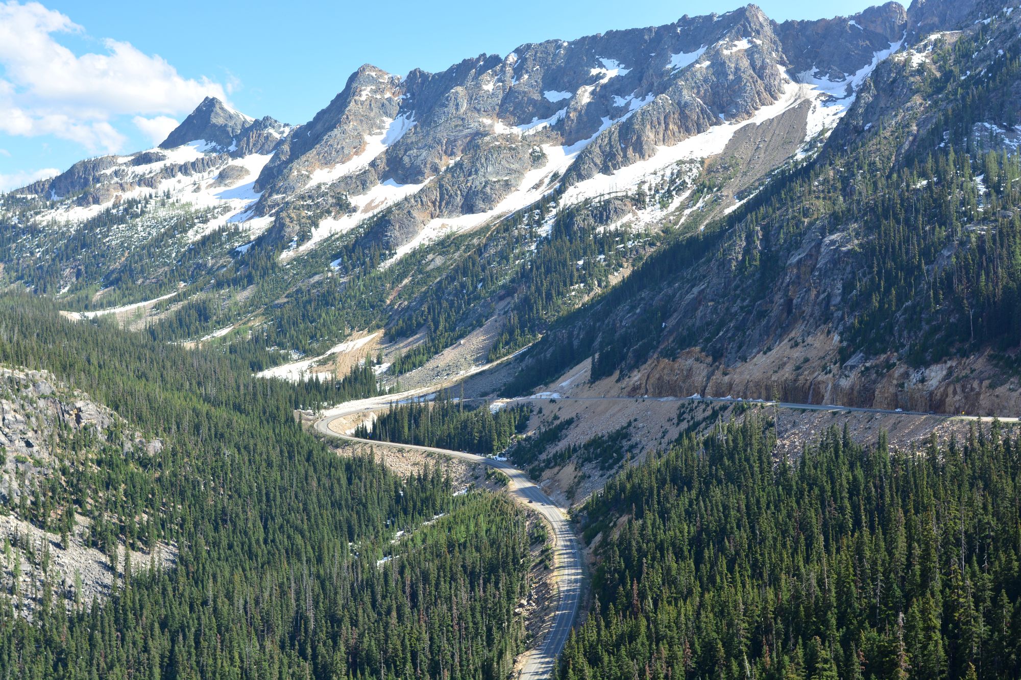
North Cascades Highway viewed from Washington Pass Overlook in early summer | Joe Mabel/CC BY-SA 4.0
Quick Decision Guide
- Scenic drive only: You do not pay an entrance fee just to visit the park complex, but you still need to check whether SR-20 is open the day you go because the highway usually closes in late fall and reopens in spring (fees and passes; SR-20 status).
- Day hike from a park trailhead: Trails that begin on National Park Service land do not have trailhead or parking fees (fees and passes).
- Day hike east of Diablo from a forest trailhead: Assume you need a Northwest Forest Pass, Interagency pass, or $5 day-use payment unless the specific trailhead page says otherwise. This is the rule at places such as Rainy Pass, Easy Pass, and Blue Lake (fees and passes).
- Backpacking or any overnight in the park complex: Backcountry permits are required year-round (permit rules).
- Traveling with a dog: Dogs are allowed on leash in Ross Lake and Lake Chelan National Recreation Areas and on most surrounding national forest land, but not on most North Cascades National Park trails except the Pacific Crest Trail and within 50 feet of roads (pets).
Before you pass Marblemount
Before you pass Marblemount
Marblemount is the last clean correction point for a lot of trips. If your goal is an overnight permit, a Cascade River Road start, or a dog-sensitive route choice, fix that before you keep driving east.
Backcountry permits are required year-round, and the Wilderness Information Center in Marblemount is the key in-person stop during its main season. When it is closed, the park posts off-season self-issue instructions outside, so overnight users should check the current process before leaving town rather than assuming they can sort it out at the trailhead (backcountry permits).
Do not plan to sleep at park trailheads before an early start. Overnight camping at national park trailheads is prohibited, including Eldorado, Boston Basin, and Cascade Pass (trail conditions).
Tip: if your route depends on Cascade River Road, remember that the turnoff is east of Marblemount near SR-20 mile marker 106, and that road has its own condition page separate from the highway report (road conditions).
Do not confuse National Park trailheads with National Forest trailheads
Do not confuse National Park trailheads with National Forest trailheads
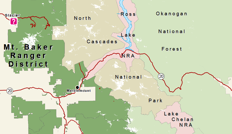
Photo: Shows US Forest Service land in dark green and light green, North Cascades National Park Service Complex in tan and pink. Attribution: US Forest Service
This is the permit mistake that wastes the most time. The park has no entrance fee, and trails that begin on National Park Service land do not have trailhead or parking fees. That does not carry over to nearby U.S. Forest Service trailheads that feed the same trip corridor (fees and passes).
On the east side, past the National Park Complex, trailheads such as Rainy Pass, Rainy Pass North, Easy Pass, and Blue Lake honor the Northwest Forest Pass, Interagency passes, and digital day-use payment. The Discover Pass is a Washington state pass and is not valid on these federal trailheads (fees and passes).
If the trailhead uses Scan and Pay, set that up before you lose service. Several forest trailhead pages specifically tell you to download the Recreation.gov app before the trip so you can pay on-site even without signal (Rainy Pass page).
Cascade River Road and Washington Pass change things the most
Cascade River Road and Washington Pass change things the most
Cascade River Road and the Washington Pass trailhead cluster are the two branches that most often change what a visitor can realistically do in one day.
For Cascade River Road, do not assume an open SR-20 means your trailhead is reachable. The road can close independently, is paved only to about mile 10, then turns to gravel, and the park warns it is not suitable for large RVs because of narrow, steep sections and sharp switchbacks (road conditions).
East of Diablo, parking pressure is the bigger trap. The Rainy Pass picnic site parking is very limited and fills quickly, and the Forest Service says Blue Lake has about 20 designated parking spots and is often full. Do not build a peak-season day around one of those trailheads unless you are willing to pivot immediately if the lot is already blown out (Rainy Pass page; Blue Lake page).
Tip: Easy Pass is east of Diablo between SR-20 mileposts 151 and 152. Blue Lake is east of Washington Pass about half a mile past milepost 162. Those are useful anchors when you have weak service and need to know whether you are still driving toward the right branch of the day
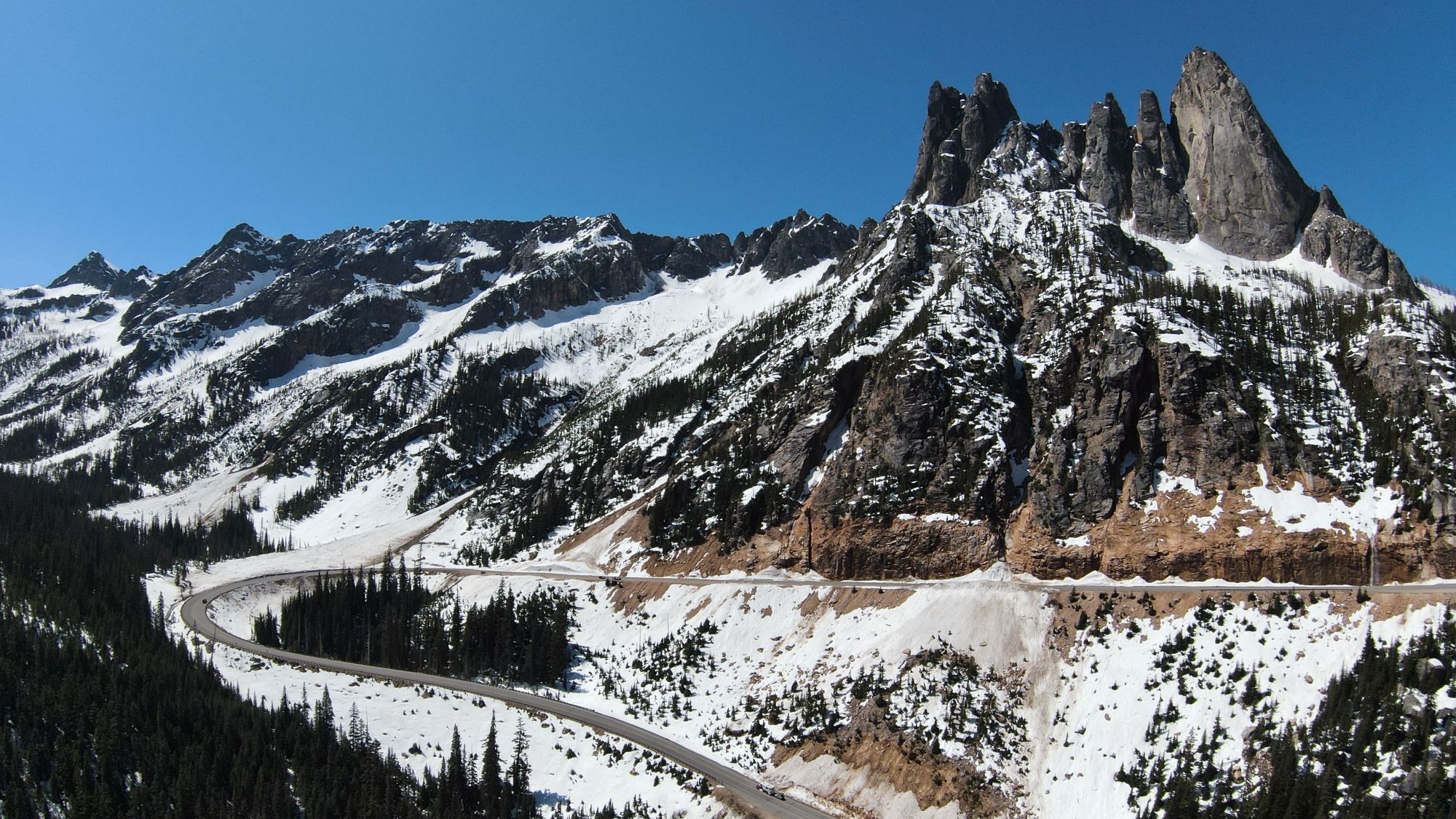
Liberty Bell Group above the North Cascades Highway near Washington Pass. Photo: © 2026 CascadesFieldGuide.com. All rights reserved.
Safety problems people underestimate
Safety problems people underestimate
Break-ins are not uncommon at SR-20 trailheads. Leave nothing visible, including charging cords and small electronics, because those are specifically called out as targets (safety).
Do not depend on your phone for navigation, payment, or last-minute rerouting. Dead spots are common, so download maps, trailhead info, and any payment app before you get deep into the corridor (safety).
Weather is the other planning mistake. The most reliable stretch is generally mid-June through late September, storms are still common, and the highest trails may not be mostly snow-free until July. A highway that is open can still lead to trailheads with snow, wind, or poor conditions for the day you had in mind.
If your trip falls in shoulder season, check three things the same morning: SR-20 status, the park road and trail pages, and any active fire closure page. That is the fastest way to catch the failure modes that change whether you stay west of Diablo, commit east to Washington Pass, or abandon Cascade River Road entirely (SR-20 status; road conditions; fire closures).
Sources
Sources
- Entrance fees and trailhead fee split (Fees & Passes)
- Overnight permit rules and off-season permit process (Backcountry Permits)
- Year-round permit requirement overview (Permits & Reservations)
- Pet rules by park and recreation area boundary (Pets)
- SR-20 and Cascade River Road access (Road Conditions)
- Current highway status and seasonal closure pattern (North Cascade Hwy SR 20)
- Trailhead break-ins and cell-service gaps (Safety)
- Seasonal weather and snow timing (Weather)
- Rainy Pass trailhead passes and parking limits (Heather Maple Pass (Rainy Pass Picnic Site))
- Blue Lake parking and day-use rules (Blue Lake Trailhead)
- Easy Pass trailhead pass rules and milepost reference (Easy Pass Trailhead)
- Hidden Lake pass exception (Hidden Lake Lookout)
- Current wildfire closures (Fire Closures)
Related Guides
This guide is for trip planning only. Conditions, rules, payment systems, seasonal access, and closures can change quickly. Check the official source the same day for current access, permits, trail conditions, and weather.